Natural features of Toyama Prefecture
Toyama Prefecture has a topography with a height difference of 4,000m, ranging from the peaks of the Northern Alps and the 3,000m Tateyama mountain range, to Toyama Bay, with a depth of more than 1,000m. The area is rich in natural surroundings, with a range of flora and fauna. Through the scenic landscapes and natural monuments and protected species designated as cultural properties, we showcase some of the natural features of Toyama Prefecture.
Volcanoes
Mt. Tateyama is one of Japan's most active volcanoes. The landscape traces its origins to volcanic activity, such as Mikurigaike Pond, which used to be a crater, and Jigokudani vally, which still produces gas today. It has had a great influence on the history and culture of Toyama Prefecture, whose scenery has been likened to Hell and paradise since ancient times.
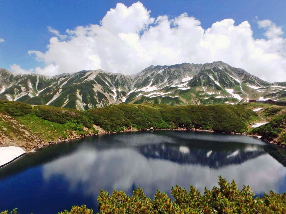
Mikurigaike Pond
Mikurigaike Pond is a limpid blue crater lake that is considered the most beautiful in the Northern Alps. It is located 10 minutes on foot from the Murodo bus terminal, with a stunning landscape as far as the eye can see.
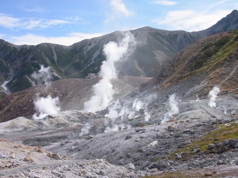
Jigokudani vally
Jigokudani vally has active gas and steam activity. Nearby is Mikurigaike Hot Springs, recognized as the hot springs in Japan at the highest elevation.
Glacier
Tateyama mountain range is where traces of a glacier were found for the first time in Japan.
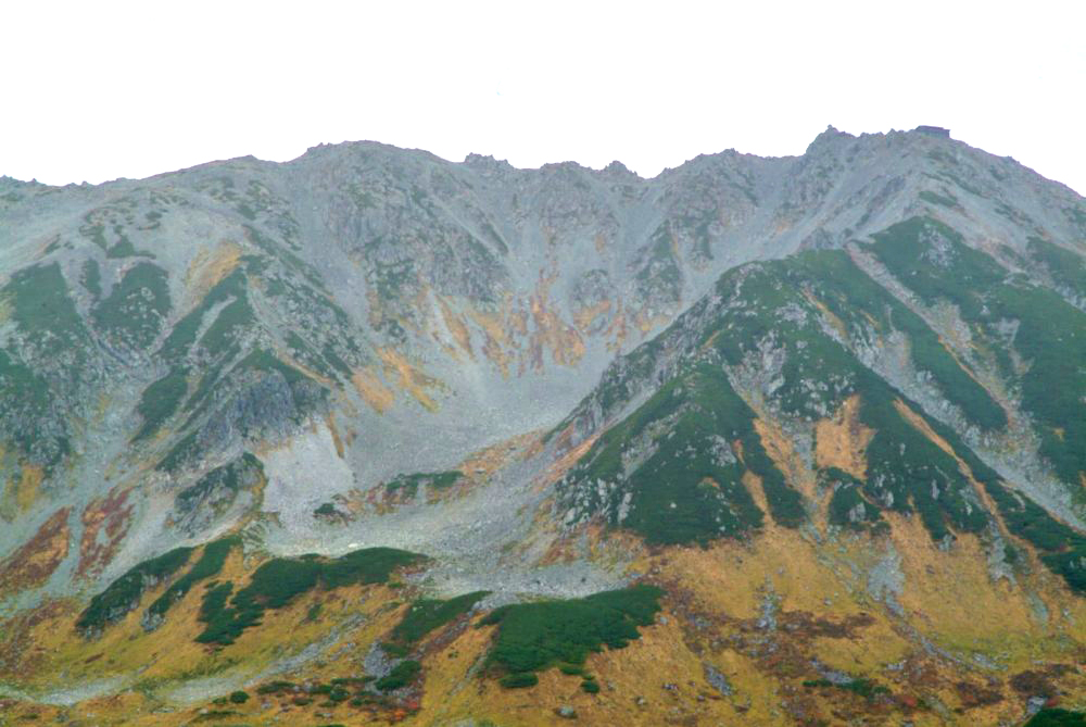
Yamazaki Cirque on Mt.Tateyama
The Yamazaki Cirque area of Mt. Tateyama is a depression on the slope between Mount Oyama and Mount Onanji that looks like a large spoon. The Cirque's topography is the result of being carved by glaciers about 30,000 to 10,000 years ago, and is designated as a natural monument under the name Mt. Tateyama Yamazaki Cirque. In 2012, three snowy Cirque were recognized as glaciers in the Mt. Tateyama mountain range. These were the first discovered and extant glaciers in Japan. The shape of the Yamazaki Cirque clearly indicates how glaciers had developed in the area.
Gorges and waterfalls
Rapid rivers originating in the Northern Alps eroded the earth. Upstream, you can see the impressive extent of these gorges and waterfalls.
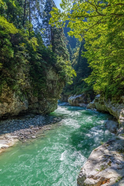
Kurobe Gorge and Sarutobi and Mount Okukane
Kurobe Gorge is a V-shaped valley with steep cliffs. Today, one can board the trolley for an 80 minute journey through nature. Sarutobi Gorge is located about 20 minutes on foot from the last station, and continues to enchant tourists.
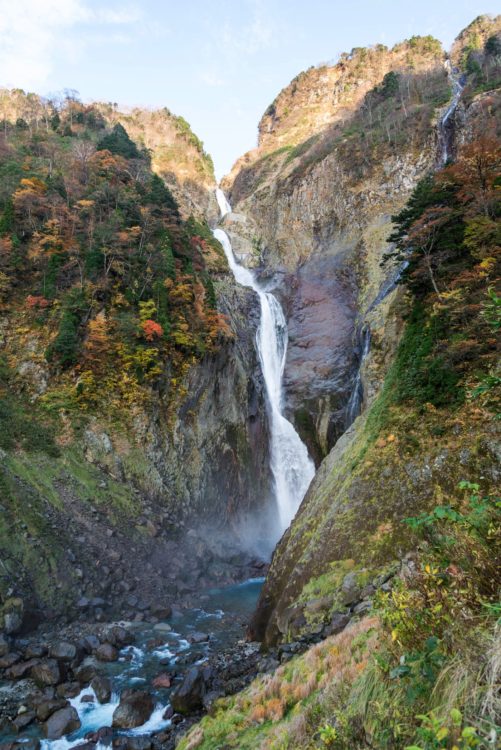
Shomyodaki Falls
Shomyodaki Falls are the largest waterfall in Japan, with a drop of 350 meters across the Midagahara plateau, carrying meltwater from the Tateyama mountain range.
Seaside and islands
The coast on the east of the prefecture has a wide spring water zone, while the scenic coast on the west side has been written about since ancient times in poetry.
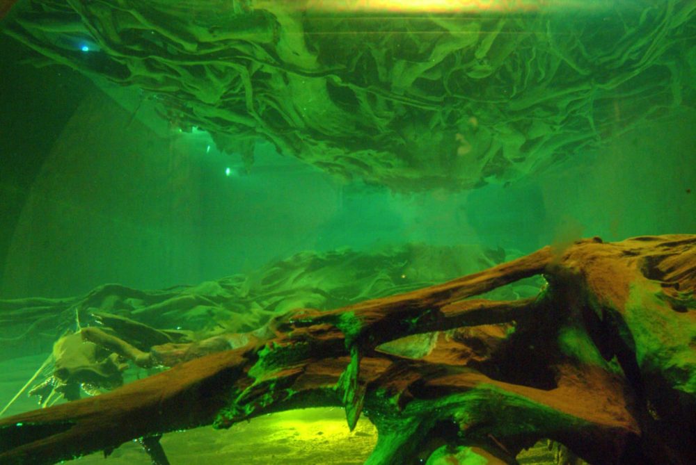
Uozu Buried Forest
The Uozu Buried Forest was where virgin wood such as cedar, once lushly growing on land, was buried by river flooding about 2,000 years ago, and then the sea level rose to push it below the current sea level. Today, it can be seen intact in the Uozu Buried Forest Museum.
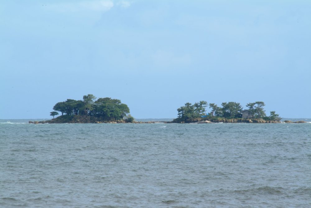
Abuga-shima Island and Environs
Abuga-shima Island spans 180m and is located on the Nadaura Coast. It, and the reefs around it, are influenced by the currents from the north and south and produce unique flora and fauna.
Fauna
Toyama Prefecture's rich natural environs are where unique endangered species can be found, as well as schools of glowing firefly squid.
Schools of swimming firefly squid
Firefly squid has many light-emitting parts on its body. This squid normally resides at 200-600m depth, but in the spring schools of squid can be found along the coast of Toyama Bay. The surface of the water seems to glow a pale blue-white and has been described as "The spiritual site of Toyama Bay," with the phenomenon of the sea illuminated by firefly squid being nationally designated as a special natural monument.
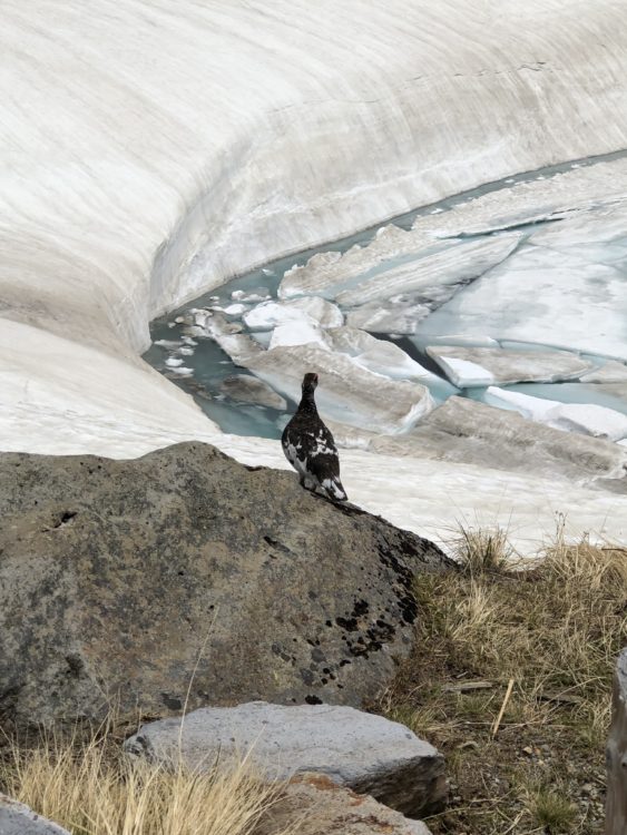
Ptarmigans
Ptarmigans are an endangered species that are nationally designated as a special protected species. Ptarmigans are widely found on the sacred Mt. Tateyama, and have been loved by locals as "messengers of the gods." They are not afraid of people and can be found on the pedestrian walkways at Mikurigaike pond.
Flora
Flora designated as cultural properties are a reflection of their habitat. These plants tend have a longstanding relationship with the people of the region.
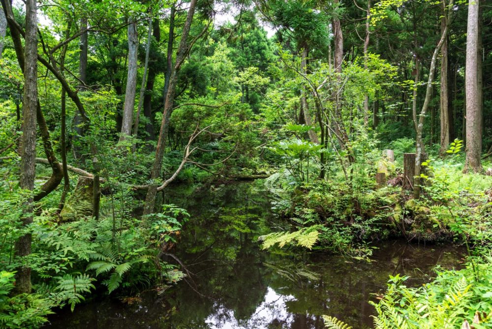
Sugisawa no Sawasugi [ Cedar forest in spring water zone ]
Sawasugi refers to a type of cedar forest that grows in the spring water zone at the end of the delta of the Kurobe River. These trees have adapted to the climate and exhibit an unusual root shape. Within the sawasugi forest are boardwalks you can use to stroll the area.
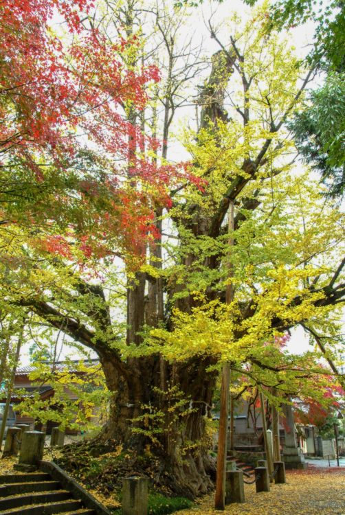
Ginkgo Tree at Jonichi-ji Temple
It is said that Jonichi-ji Temple’s ginkgo tree was planted as a sacred tree in 681 when the temple was founded. It is 24m tall and has a trunk circumference of 11.5, making it one of the country's largest and most sacred. The tree bears a considerable amount of fruit in autumn.
Related Cultural Heritage
- Shomyodaki Falls and its Basin [ Akushiro no Kabe, Shomyodaki Falls, Shomyo Rouka, Mikurigaike Pond ]
- Yamazaki Cirque on Mt.Tateyama
- Kurobe Gorge and Sarutobi and Mount Okukane
- Shomyodaki Falls
- Uozu Buried Forest
- Abuga-shima Island and Environs
- Sugisawa no Sawasugi [ Cedar forest in spring water zone ]
- Ginkgo Tree at Jonichi-ji Temple
